
Del City ZIP Code Coverage
Official local and postal material supplies three ZIP leads for Del City mailing geography: 73115, 73117, and 73135. The research did not retrieve authoritative ZIP polygons or USPS city-and-state result rows for every address. That limitation is important. A ZIP code can route mail to a Del City address without defining the incorporated city, its neighborhoods, or the correct record custodian. Verify the complete address through USPS before relying on any row below.
| ZIP lead | Documented local use | Postal label or facility note | What still needs checking |
|---|---|---|---|
| 73115 | Used by official Del City addresses, including City Hall, library, and municipal contacts | Del City appears in official local address formats | Confirm the current USPS city-and-state result and ZIP+4 for the exact street address |
| 73117 | Appears in official postal material associated with the Oklahoma City/Eastside service area | A mailing city can be Oklahoma City near Del City | Check address-level assignment, city limits, and parcel location separately |
| 73135 | Appears in official postal material associated with Oklahoma City service | Postal association is not a municipal boundary | Confirm the USPS result and the physical municipality before requesting local records |
The Del City ZIP code directory should therefore be read as a set of verified starting points, not a claim that every part of the city uses all three codes or that no other delivery distinction exists. Do not assign a neighborhood to a ZIP from a general map. Run the address through the postal lookup, preserve the returned mailing city, then compare it with the Oklahoma County parcel and city-limit information. A complete mailing form can be useful in a record search, but it does not identify a person at that address.
Del City ZIP Code Tools
The official USPS ZIP Lookup offers three separate routes. “By Address” standardizes a full mailing address. “By City and State” returns ZIP possibilities for that city-and-state combination. “Cities by ZIP” shows the city and state associations for a ZIP. Use the first route whenever a street address is available. It is the only one of the three that can narrow an address to its current standardized delivery form.
| USPS lookup route | Input captured in the research | Use with Del City records |
|---|---|---|
| By Address | Street address, city, and state; company and apartment or suite are optional | Standardize a known address before searching county property records |
| By City and State | City and state combination | Find possible postal codes, then verify each complete address |
| Cities by ZIP | ZIP input | Retain every returned city association rather than choosing one by assumption |
USPS expressly says that a lookup result does not confirm that a person or company is at the address. The USPS AIS Viewer is a separate address-quality resource with monthly updates, delivery-type information, county retrieval, ZIP+4, and address lookup products. It recognizes street, rural, PO Box, general delivery, unique, military, and non-active delivery types. AIS has subscription and access rules, so it should not be presented as a free parcel map. For parcel boundaries, use county GIS and the recorded land record instead.
USPS guidance on ZIP basics is a useful reminder that postal routing and municipal geography are separate systems.
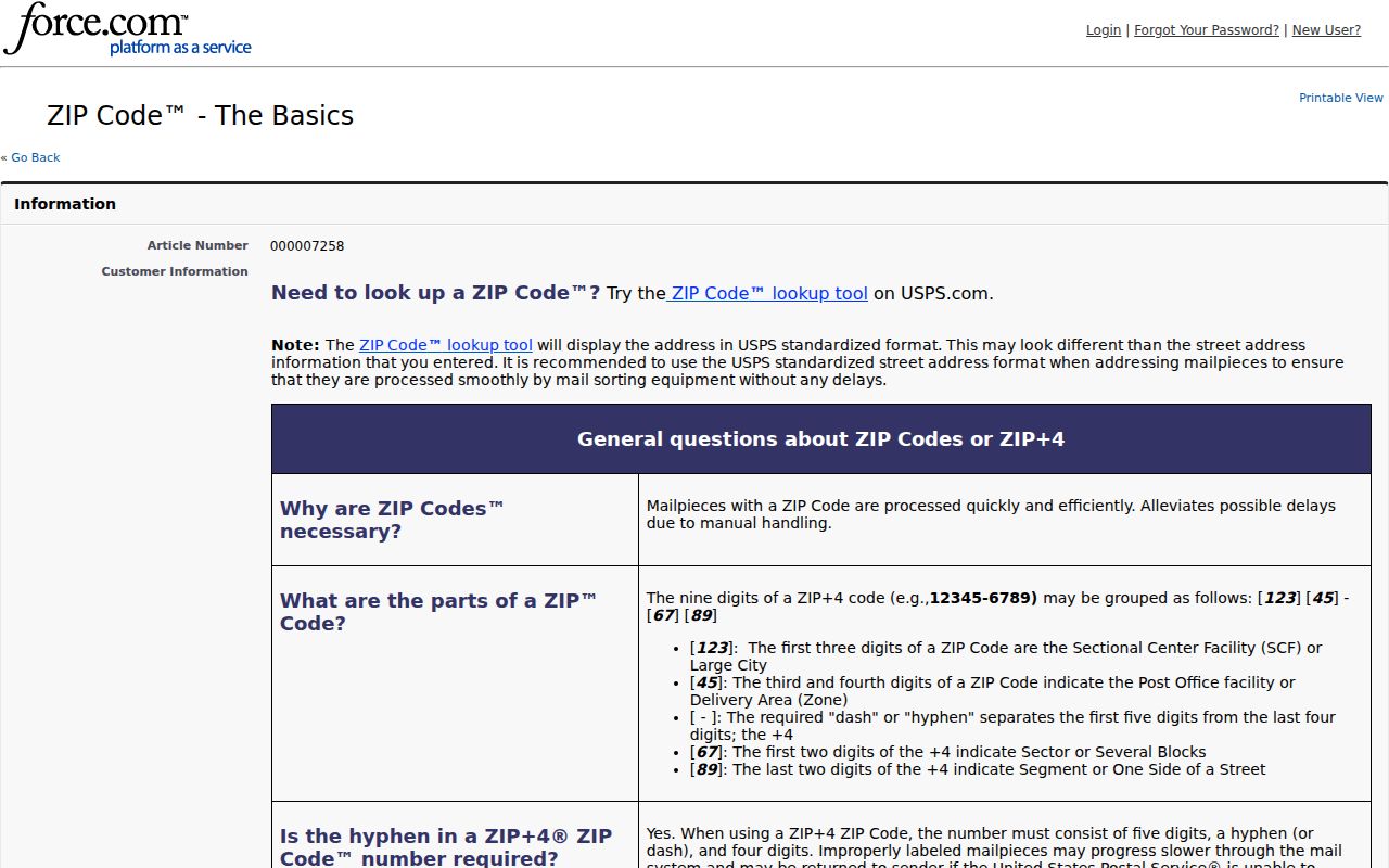
The mailing-city label shown by USPS should remain in the research note even when the county parcel map uses Del City for the physical municipality. Keeping both labels makes a later custodian request easier to route and audit.
Search a Del City ZIP Code
To find a resident tied to a known address in one ZIP, first standardize the address and then use the record system that holds the particular fact. A ZIP-wide resident result is not a documented search field in every Del City record system. The Oklahoma County Assessor’s visible options are name, physical address, real account, personal account, centrally assessed account, subdivision, block and lot, map, deed book and page, and occupant or building name. The election material describes an individual portal and registration or history file routes, not a published ZIP filter.
- Use USPS By Address to capture the standardized street, city, state, ZIP, and ZIP+4 for a specific address. Record the retrieval date because postal assignments can change.
- Search the Assessor by the standardized physical address. If the search fails, retain the directional prefix and block number, then use the official owner, legal-description, subdivision, or account alternatives. The Assessor does not document a ZIP search mode in the reviewed material.
- Open the Oklahoma County GIS Hub to compare the parcel, city-boundary relationship, roads, and subdivision context. GIS provides map context, not a legal survey; the deed controls the legal description.
- For a defined election-record question, use the individual voter portal or ask the election custodian about its current registration or history file route. Specify the county or precinct and an as-of date where appropriate. Do not request a custom household roster or assume that a ZIP is an available filter.
Once the postal form and parcel are narrowed, use the Del City street directory for the address-based record sequence. A ZIP can organize the search, but the legal description, record date, and responsible custodian decide what the result means.
Del City ZIP Code Boundaries
Postal and municipal lines disagree most often where an address is close to a city edge. ZIP 73115 can route a search toward Del City addresses without proving city limits. ZIP 73117 or 73135 can return an Oklahoma City mailing label even when the physical address is close to, or within, a different jurisdiction. Do not replace the postal label with the municipal one. Keep them side by side, then use the ODOT Del City map, county GIS, and the parcel record to determine where an address lies.
Del City’s documented geographic frame helps explain why this comparison is necessary. The OHS history identifies NE 10th and SE 44th as north-south boundaries, Sooner Road and Bryant as east-west anchors, with I-40 crossing the city. Older records can also use Carter Park, Midway Village, the Tinker-area edge, Boone Township, or an Oklahoma City-area label. Carter Park was absorbed in 1954, Midway Village in 1963, and the Tinker-area boundary was resolved in 1964. Those history details are useful search vocabulary, not proof of a current ZIP assignment.
Boundary check. When USPS returns Oklahoma City for an address near Del City, preserve that mailing result and compare the address with the ODOT map, the city-limit layer, and the county parcel. The comparison helps identify the proper city, county, or state records custodian.
Del City ZIP Records Requests
Use a postal label as a narrow search term, not as a request for all people in an area. Del City’s open-records form asks for a record description, date range, and semicolon-separated search terms. A focused request can combine an address, an addition or subdivision name, a defined record type, and dates. The Oklahoma Open Records Act covers existing public records, while allowing exemptions, redaction, confidentiality, and safety protections. The agency that holds the record does not have to create a new report from its data.
For a property question, the Assessor online route is the first stop, followed by the County Clerk’s public land-record index and the Clerk office for an official or unredacted copy. For city limits or visual parcel context, use the GIS Hub and verify a legal description in the deed. USPS supports online address and city routes; its AIS Viewer has a different subscription-access model. When an online search does not answer the question, retain the attempted address, source URL, date, filters, and exact result. Mark it as not located, not digitized, not public, or needing an in-person search instead of treating it as a negative fact.
Postal assignments, portal fields, and municipal fees can change. The research supporting these routes was retrieved or described as of August 30, 2026. Carry a retrieval date with every ZIP result and check the current custodian page before acting on an older screen capture or a saved address form.
Del City ZIP Search Audit
A failed postal or parcel search needs a record of its own. Write down the complete address submitted, the returned city and state label, the date, the URL, and any ZIP or ZIP+4 displayed. Also record whether USPS gave no result, the Assessor search failed, GIS could not locate a parcel, or an office withheld a record. That detail separates a genuine routing problem from an address spelling issue, a system outage, a privacy limit, or a collection gap.
For Del City research, use clear labels such as “not located in official index,” “not public,” “not digitized,” “coverage gap,” and “needs in-person search.” Those notes are especially useful when an older address appears under Boone Township, Oklahoma City, Carter Park, Midway Village, or a subdivision name instead of the modern municipal label. They preserve the uncertainty without turning a missing result into a claim that the address, parcel, or resident never existed.
Del City ZIP Delivery Types
Postal delivery type is another reason not to treat a ZIP as a boundary. The USPS AIS material identifies street, rural, PO Box, general delivery, unique, military, and non-active categories. Each describes how USPS handles delivery, not a parcel’s ownership, a person’s current presence, or a city’s legal extent. A PO Box or unique assignment can be a valid mailing detail while providing no physical address for a county-record search.
When a record lists only a mailing address, keep it distinct from the property’s physical address and legal description. The Assessor can show both mailing and physical fields, while the County Clerk instrument supplies the land description to verify. For an address near the Tinker-area edge or another jurisdictional boundary, retain the delivery type and postal label as context, then rely on the parcel, deed, and city-limit information for the geographic conclusion.
Del City ZIP Code Vocabulary
Postal terms can look more precise than they are. The definitions below keep an address check within the limits of the USPS material and prevent a mailing designation from becoming a claim about a resident, a neighborhood, or a legal boundary.
- ZIP and ZIP+4
- A ZIP identifies a broader postal delivery area. ZIP+4 adds a more specific delivery segment. An exact street address and ZIP+4 distinguish addresses better than a ZIP alone.
- PO Box ZIP
- A postal designation used for box delivery. It does not establish the location of a home, parcel, or municipal jurisdiction.
- Unique ZIP
- A delivery designation that USPS may use for one institution or organization. It is a postal classification, not evidence that the institution controls the surrounding area.
- Carrier route
- A USPS delivery grouping. It helps postal operations and is not a city boundary, parcel line, or list of residents.